Catalog Archive
Auction 150, Lot 266

"New York and Brooklyn", Mitchell, Samuel Augustus

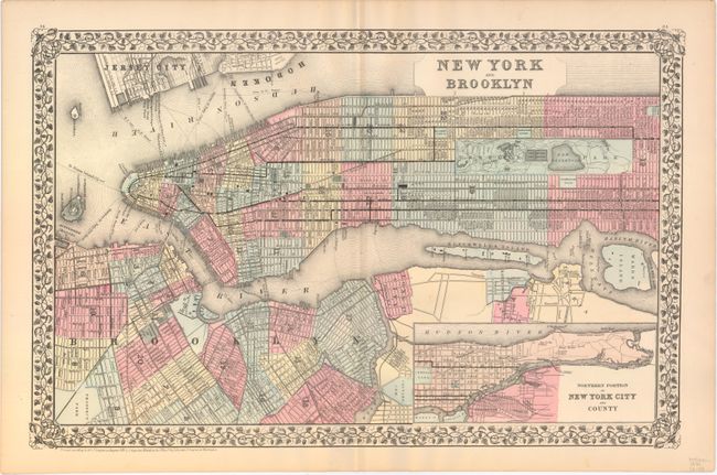
Subject: New York City, New York

Period: 1881 (dated)

Publication: New General Atlas

Color: Printed Color

Size:
21.1 x 13.5 inches
53.6 x 34.3 cm
Download High Resolution Image
(or just click on image to launch the Zoom viewer)

This fascinating map of New York City covers Manhattan from the Battery to Central Park, as well as Brooklyn and small parts of Queens, Jersey City, and Hoboken. An inset at bottom right details the northern part of the island. Streets, railroads, ferry routes (with notes on distance), parks, and ship yards are shown. The Brooklyn Bridge, still under construction at the time, appears.

References:

Condition: A

Light toning along sheet edges.

Estimate: $200 - $230

Sold for: $150

Closed on 9/17/2014

Archived