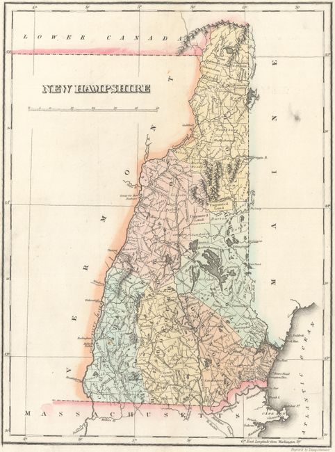
Subject: New Hampshire
Period: 1822 (circa)
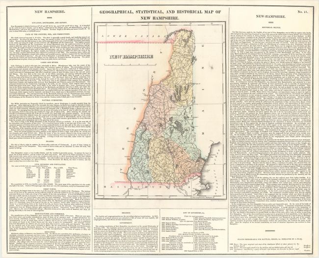
Publication: A Complete Historical, Chronological, and Geographical American Atlas
Color: Hand Color
Size:
8.9 x 12 inches
22.6 x 30.5 cm
This first edition map is on a full folio sheet (20.6 x 16.8") with surrounding text describing boundaries, climate, natural curiosities, chief towns, religion, commerce, government, history and more interesting information. The state is up to date with six counties delineated. A list of governors beneath the map spans from John Cutts in 1680 to Samuel Bell in 1821. The historical sketch details New Hampshire's history from John Smith's discovery to statehood, concluding with the following: "Since the adoption of the federal constitution, no event of historical importance has occurred in New Hampshire." Battles with the Indians are marked with flags around Dover and Charlestown. Engraved by Young & Delleker.
References:
Condition: B+
Original color. Trimmed close to neatline at bottom, with short centerfold separations at top and bottom that have been professionally repaired.