Subject: Boston, Massachusetts
Period: 1844 (dated)
Publication:
Color: Black & White
Size:
11.3 x 9.8 inches
28.7 x 24.9 cm
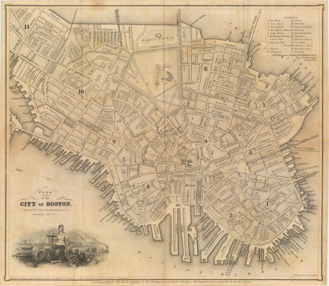
This striking plan of the Cradle of Liberty features excellent detail around the Boston Harbor. A key in the top right corner identifies 21 places of interest, including city hall, Faneuil Hall, Tremont House (the first hotel to have indoor plumbing and running water), and Dickinson's Printing Establishment & Type & Stereotype Foundry, where this very map was printed. Streets, bridges, and railroads are named. A note below the title indicates that the city's population was 120,000 at the time of publication. The vignette below the title depicts a crowned young woman seated on an anchor next to an overflowing cornucopia with the harbor and city as a backdrop. North is oriented to the right. Printed by S.N. Dickinson, with the following note next to his imprint: "This Map is a specimen of Plate Printing by a new process affording a third longer wear from a plate than by the old method."
References:
Condition: B+
Issued folding on banknote paper with light toning, some spots, and a few tiny splits at fold intersections.