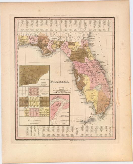
Subject: Florida
Period: 1839 (dated)
Publication: Tanner's Universal Atlas
Color: Hand Color
Size:
10.9 x 13.4 inches
27.7 x 34 cm
This map of Florida shows towns, railroads, forts, roads, canals, major rivers, and lakes. There are references to forts, battlefields, and routes used by the Army during the Seminole War. There are also three inset maps detailing Pensacola, Tallahassee, and St. Augustine. The map reflects the configuration of counties in 1838 with the recent organization of Calhoun County, although Mosquito County is far too large and is named Leigh Read, which came into de facto use in 1842. Water routes from St. Augustine and Pensacola to various ports are described above and below the map. Published by Cary & Hart.
References:
Condition: B
Original color with light toning and minor soiling.