Subject: Colorado
Period: 1877 (dated)
Publication:
Color: Printed Color
Size:
19.3 x 27.3 inches
49 x 69.3 cm
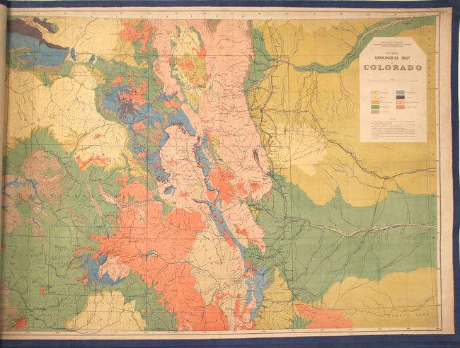
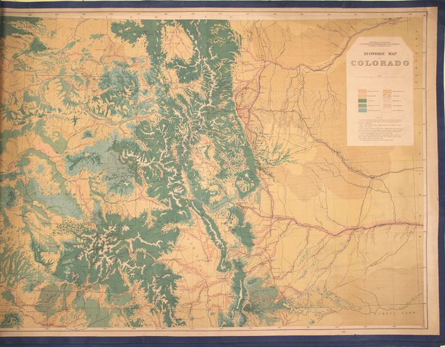
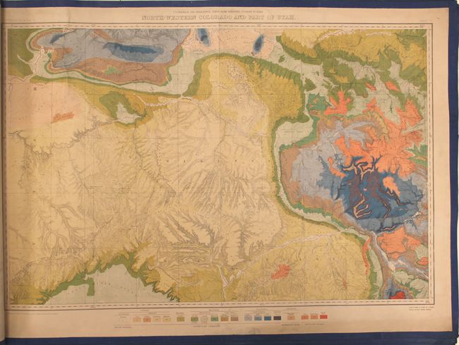
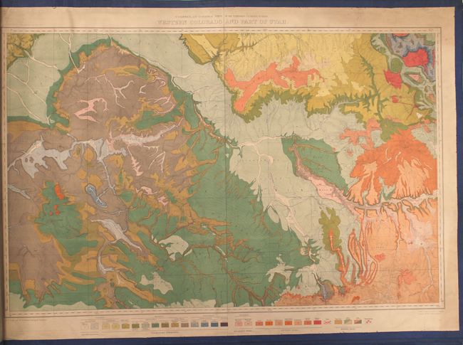
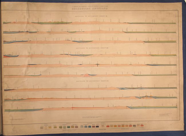
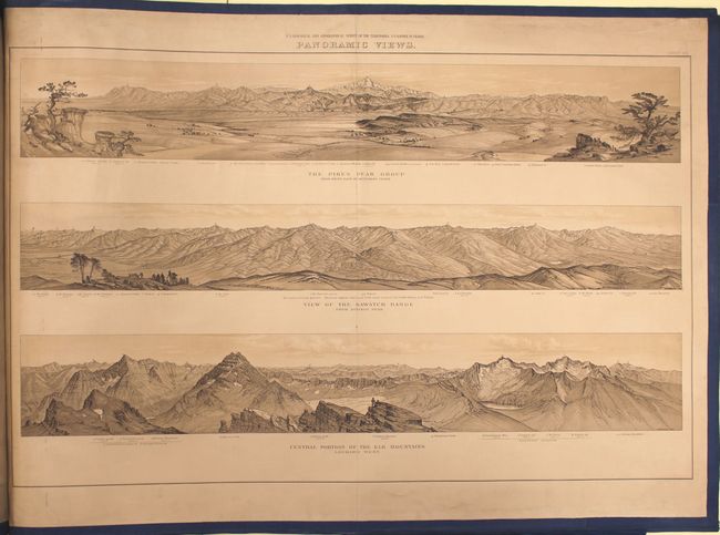
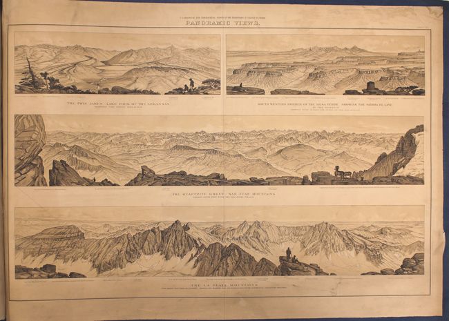
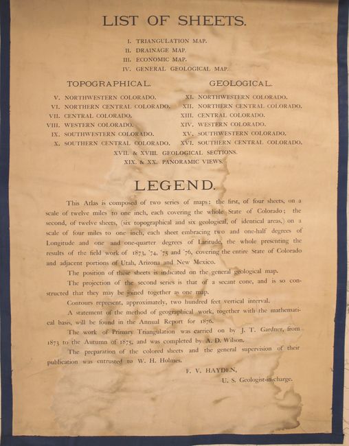
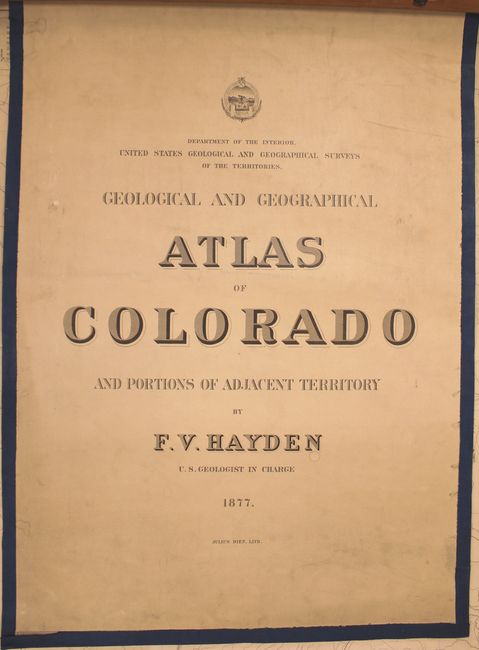
According to Wheat, the 1877 atlas "was the highest expression of the labors of the Hayden Survey in Colorado" and is the visual result of the monumental field work that was completed from 1873 through 1876, covering the entire State of Colorado and adjacent portions of Utah, Arizona and New Mexico. This example includes 10 color maps and 19 of the 20 issued double-page maps (missing Sheet VII - topographical map of central Colorado). The first four maps cover the entire state of Colorado (triangulation, drainage, economic and geological) on a scale of 12 miles per inch. The next 11 (of 12) are topographical and geological maps of identical regional areas on a scale of 4 miles per inch. The maps are followed by two geological sections and two sheets of beautifully rendered panoramas from around the state including Pike's Peak, Sawatch Range, Elk Mountains, the San Juans and La Plata Mountains. Lithographed by Julies Bien. Maps measure approximately 35 x 22.5".
References: Wheat (TMW) #1281.
Condition: B
All of the maps have been backed in linen with blue ribbon lining the sheet edges. A working example, the maps are held together by two wooden rods and metal bolts in the left blank margin of the sheets. The maps have minor to occasionally light soiling, a few small damp stains, and occasional light abrasions along the centerfold. The geological sections (sheet 17 and 18) have some rippling at top left and the table of contents has a large damp stain.