Subject: Southwestern United States
Period: 1855 (dated)
Publication: General Atlas
Color: Hand Color
Size:
14.6 x 11.7 inches
37.1 x 29.7 cm
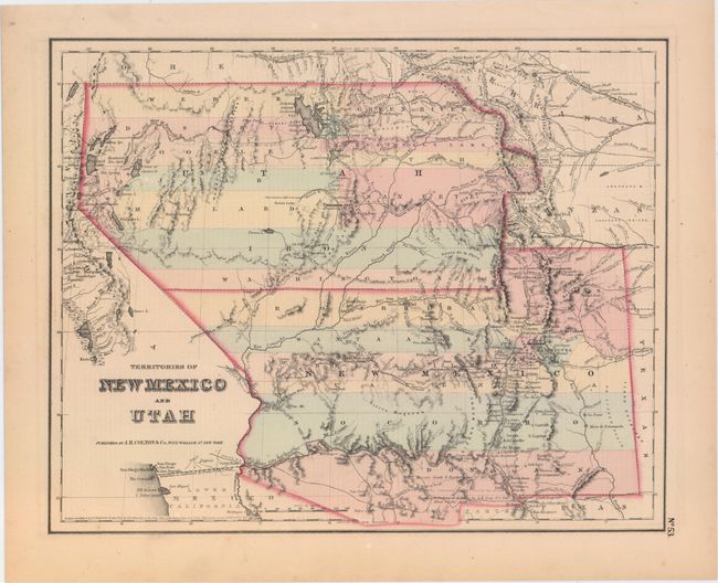
A very interesting map that depicts the region with the largest extents of Utah and New Mexico territories. Utah Territory encompasses all of today's Nevada and extends east to the Continental Divide into present-day northern Colorado with Fillmore City as its capital. Kanzas is to the east of Utah Territory. New Mexico Territory stretches between California and Texas and includes part of present-day southern Colorado and the southern tip of Nevada. Fremont's routes, proposed routes for the Pacific Railroad, the Spanish Trail, and much more are located. This is the fourth state of the map, with the plate number 53 in the lower right corner, with the plain border of the General Atlas. Text related to California on the verso.
References: Wheat [TMW] #832; Brown (Portolan - Spring 2005) pp. 48-51.
Condition: A
Very light, even age toning.