Catalog Archive
Auction 150, Lot 191

"A Correct Map of the Georgia Western Territory", Morse, Jedidiah (Rev.)

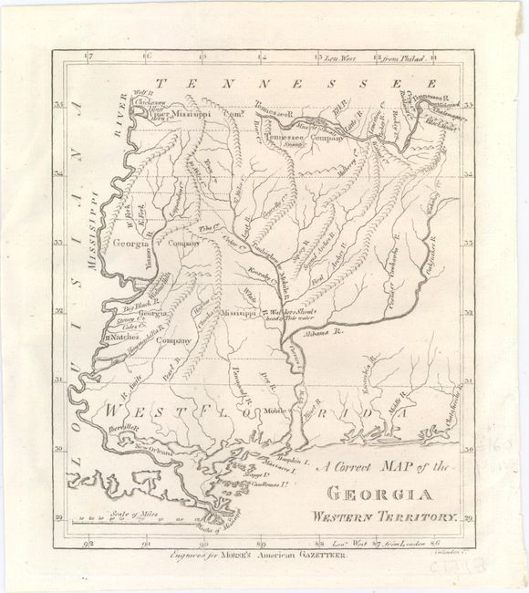
Subject: Mississippi & Alabama

Period: 1797 (published)

Publication: Morse's American Gazetteer

Color: Black & White

Size:
6.1 x 7.2 inches
15.5 x 18.3 cm
Download High Resolution Image
(or just click on image to launch the Zoom viewer)

An interesting and historical map that covers the region that would become Mississippi and Alabama. There is good information on the watershed, and some topography is shown. Many rivers are named, but only four towns: New Orleans, Natches, Mobile, and Pensacola. Along the Mississippi River are lands of the Upper Mississippi Company and the Georgia Company, and to the east is the Tennessee Company. These lands were a part of the infamous Yazoo Land Fraud. In 1795 the governor of Georgia, George Mathews, signed a bill that agreed to sell almost 40 million acres to speculators in the Yazoo Land Act. This corrupt land deal led to the downfall of many popular politicians. President George Washington, speaking about Yazoo said, "These acts embrace an object of such magnitude and in their consequences may so deeply affect the peace and welfare of the United States..." Read more about this early scandal here.

References: Wheat & Brun #618.

Condition: A

Issued folding.

Estimate: $300 - $375

Sold for: $210

Closed on 9/17/2014

Archived