Catalog Archive
Auction 150, Lot 102

"Carte Generale des Decouvertes de l'Amiral de Fonte, et Autres Navigateurs Espagnols, Anglois et Russes pour la Recherche du Passage a la Mer du Sud", Robert de Vaugondy, Didier

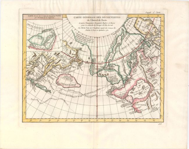
Subject: Western North America

Period: 1752 (dated)

Publication: Diderot's Encyclopedia (Supplement)

Color: Hand Color

Size:
15 x 11.5 inches
38.1 x 29.2 cm
Download High Resolution Image
(or just click on image to launch the Zoom viewer)

The Encyclopedie was published under the direction of Diderot from 1751 onward with thousands of articles written by the most prominent philosophers and scientists of the time. These great minds collaborated in the goal of assembling and disseminating the fruits of accumulated knowledge and learning. This massive reference work for the arts and sciences, served to propagate Enlightened ideas. Read a full description of this work and Diderot at Wikipedia.com.

This is one of the more remarkable combinations of fact and fiction ever published. This map of the North Pacific and Northwest had as its source a 1708 article in the Monthly Miscellany that purported to be a newly discovered account of a voyage in 1640 by the Spanish Admiral, Bartholomew de Fonte. Thereafter, the newly presented information was changed and elaborated upon, notably by this series of maps which appeared in Diderot's Encyclopedia. In its concept, it promoted the hopes of a Northwest Passage and depicts the existence of Mer de l'Ouest or the Sea of the West. The tracks for the Russian exploration in 1741 and other explorers are traced in the Pacific. Inset at upper left is a small map, "Carte dressee Sur la lettre de l'Amiral de Fonte par l'Ecrivain de la Californie" detailing the purported track of Admiral de Fonte.

The title credits Delisle as the source for the map. There was much controversy at the time regarding the veracity of the voyages by de Fonte. In 1750, Joseph-Nicolas Delisle presented a paper and map at the Academy of Sciences in Paris that consolidated the vast amount of geographical information he had acquired in Russia. The paper caused a sensation, but the map, drawn by Philippe Buache and designed to show the "coherence of Russian discoveries with those of de la Fuente" (de Fonte), was met with skepticism. Delisle hired Bellin to re-work the map, presenting it to the Academy in 1752. That same year an annoyed Buache drew his own map and presented it along with a paper to the Academy. The controversy was further enflamed by Robert de Vaugondy's own presentation to the Academy the following year when he expressed his doubts about the truth of de Fonte’s voyages and criticized the maps illustrating it. See Pedley pages 74-78 for more on the politics and personalities in this fascinating story.

References: Hayes pp. 26-27; Pedley #454.

Condition: A

A fine impression on watermarked paper with attractive color.

Estimate: $250 - $325

Sold for: $150

Closed on 9/17/2014

Archived