Subject: Atlases
Period: 1852 (published)
Publication:
Color: Hand Color
Size:
14 x 17.3 inches
35.6 x 43.9 cm
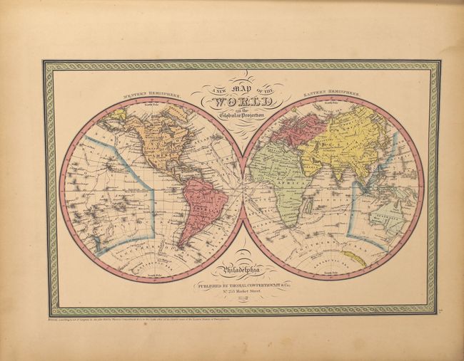
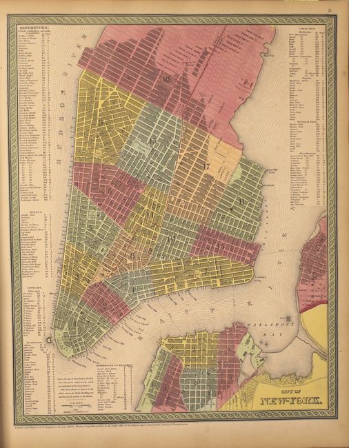
The title continues "With a special map of each of the United States, Plans of Cities &c. Comprehended in seventy four sheets and forming a series of one hundred and twenty two Maps Plans and Sections." This is an attractive copy of this famous and highly sought after atlas, complete with 74 hand-colored maps of the world, North America and the other continents, Oceanica, the United States and its territories, and numerous city plans.
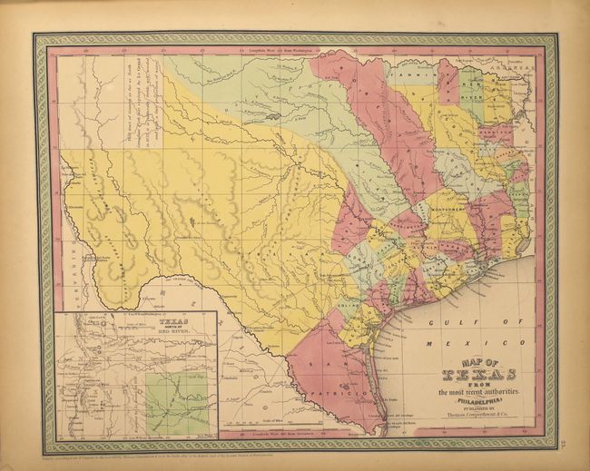
The map of Texas, first issued in 1846 by Mitchell, depicts the new state boundaries that were determined by the Compromise of 1850 with the panhandle in an inset "Texas North of Red River" at lower left. San Patricio occupies the south tip while Milam and Robertson are long counties that begin at the Nacogdoches-San Antonio road and arc to the northwest all the way to the Red River. The comment in the panhandle claims that the area "as far as North Canadian Fork was explored by Le Grand in 1833, [and] it is naturally fertile, well wooded, and with a fair proportion of water" is from Arrowsmith's 1841 map.
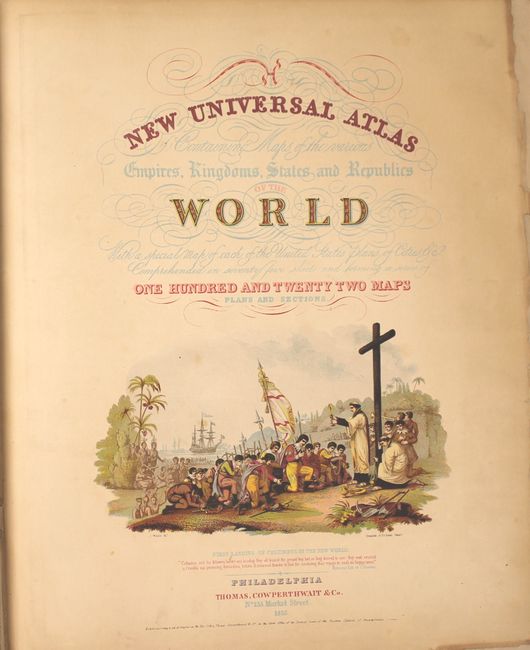
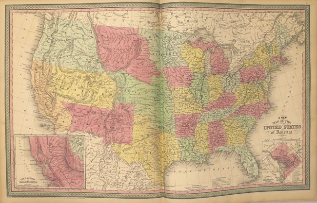
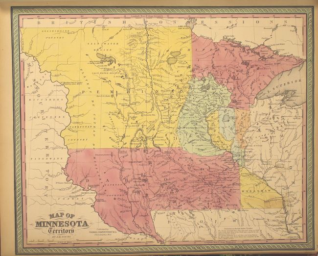
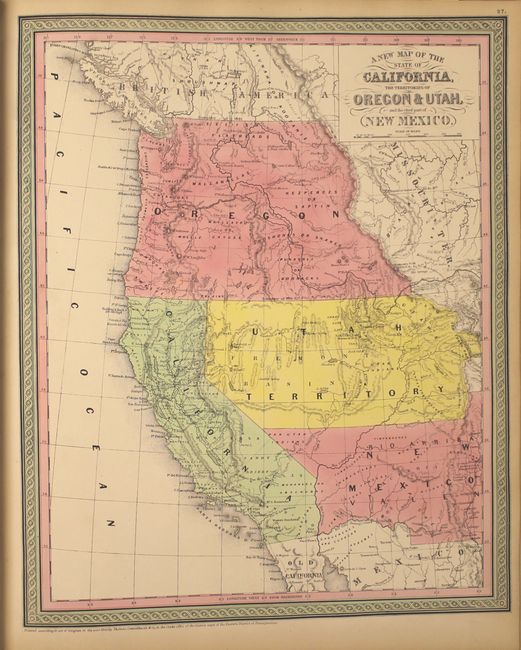
The impressive map of the west has Oregon extending to the Continental Divide, the huge Utah territory extending from California to Indian Territory, and New Mexico occupying all of the Southwest with a pre-Gadsden Purchase border. The double-page map of the United States features the same borders depicted in the western map, plus it has a large inset "Gold Region of California." The map of Minnesota features the large region of Pembina extending to the Missouri River. The frontispiece is a hand-colored, engraved diagram showing the lengths of rivers and heights of mountains. The title page includes a fine chromolithographic image titled "First Landing of Columbus in the New World."
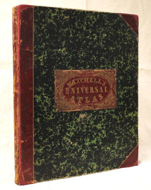
Folio. Hardbound, frontis, pictorial title page, table of contents, 74 hand-colored maps. Bound in original marbled paper with red leather tips and spine, and a red leather title label on front cover. This edition was published by Thomas, Cowperthwait & Co. who had purchased the copyright from Samuel Augustus Mitchell in 1850.
References:
Condition: B+
The maps, in original color, are in overall very good to near fine condition with some light toning along the sheet edges. The maps of Maine and New Hampshire/Vermont have a small rust stain in the image and the Wisconsin and Minnesota maps are trimmed to the border as issued. Some minor chips along the sheet edges of the title page have been replaced with old paper, and the top right corner of the front endpaper has been removed. Covers and spine are moderately worn and bumped.