Subject: Western Hemisphere - America
Period: 1795 (dated)
Publication:
Color: Black & White
Size:
8.8 x 9.4 inches
22.4 x 23.9 cm
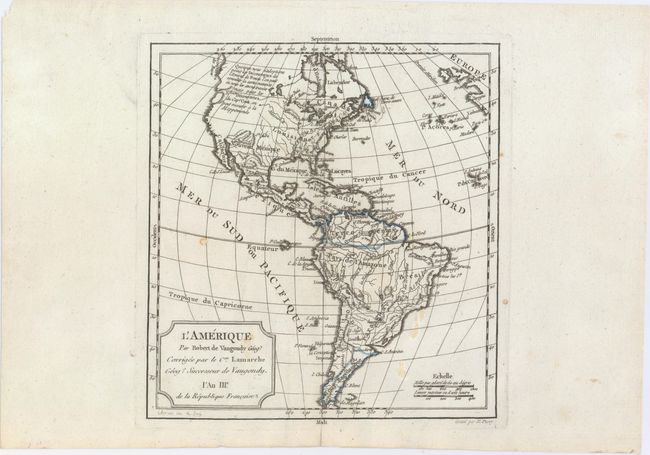
This handsome small map of the Americas is based on Robert de Vaugondy's map of the same title (1762). The western coast of North America is truncated with a partial coastline and a notation indicating a possible Northwest Passage per the supposed discoveries of Admiral de Fonte. In an update from the Robert de Vaugondy original, Captain Cook's new discoveries in the Pacific Northwest are noted as well. The British Colonies are confined east of the Mississippi River. Engraved by E. Dussy.
References:
Condition: B+
Wide margins with a few small stains and a short centerfold separation in the bottom blank margin that has been closed on verso with archival tape.