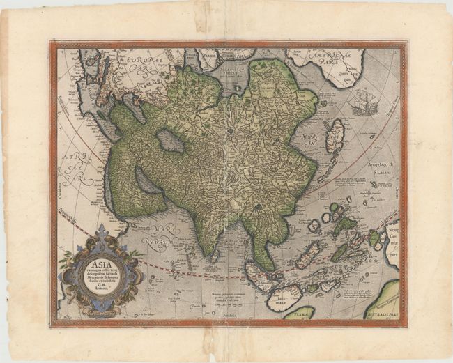
Subject: Asia
Period: 1628 (circa)
Publication: Gerarti Mercatoris Atlas sive Cosmographicae…
Color: Hand Color
Size:
18.4 x 14.9 inches
46.7 x 37.8 cm
Derived from the elder Mercator’s world map of 1569, this map of Asia was engraved by his grandson. The coasts of Northeast Asia and Northwest North America are separated by Gastaldi's fabled Strait of Anian. South of this strait a beautifully engraved galleon gives speculation to the possibility of a northern route to Asia. Sumatra has a curiously archaic outline, while the relationship between New Guinea and Terra Australis is left to the viewer's imagination. The place names, Beach, Regio, Lucach and Maletur are all taken from Marco Polo's account, but erroneously ascribed to locations in the vicinity of present-day Australia. French text on verso, published between 1628-33.
References: Yeo #13; Parry #3.13, Van der Krogt (Vol. I) 8000:1A.
Condition: C+
A nice impression with original color and wide margins. There are numerous small separations and tears along centerfold that have all been archivally repaired.