Catalog Archive
Auction 149, Lot 605

"Nouvelle Carte de la Terre Sainte pour Servir a l'Intelligence de l'Ancien, & du Nouveau Testament", Anon.
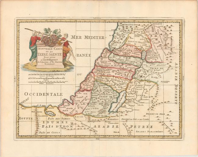
Subject: Holy Land

Period: 1750 (circa)

Publication:

Color: Hand Color

Size:
14.9 x 10.7 inches
37.8 x 27.2 cm
Download High Resolution Image
(or just click on image to launch the Zoom viewer)

This is a handsome map showing the divisions of the twelve tribes in the Holy Land, with many place names and topographical details. A decorative title cartouche adorns the map featuring Moses' spies carrying the fruit from the Promised Land.

References:

Condition: A

A nice impression and color on watermarked paper with a printer's crease adjacent to centerfold and a hint of toning along sheet edges.

Estimate: $160 - $190

Sold for: $160

Closed on 5/21/2014

Archived