Catalog Archive
Auction 149, Lot 604

"Situs Terrae Canaan, sive Terrae Promissionis, hodie Palestinae, SS. Bibliorum... / Partie Orientale, dela Terre de Canaan a Present la Palestine", Sanson/Mortier
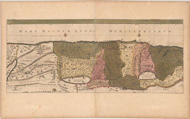
Subject: Holy Land

Period: 1708 (published)

Publication: Atlas Nouveau

Color: Hand Color

Size:
36.6 x 15.4 inches
93 x 39.1 cm
Download High Resolution Image
(or just click on image to launch the Zoom viewer)

Sanson based this map of the Holy Land on Christiaan van Adrichom's stunning map, i>Situs Terrae Promissionis, however with the Mediterranean oriented at the top of the map. The map extends from the Nile delta to Sidon and is divided into the twelve tribes. There is no bend where Palestine meets Egypt, and the Kishon River erroneously connects the Sea of Galilee with the Mediterranean. The map is finely engraved with minute detail and depicts numerous biblical scenes including the Exodus, the wandering of the Children of Israel, and several battle scenes. Two compass roses erroneously orient north to the top of the map. Published by Pieter Mortier. On two sheets, joined as issued.

References: Laor #25.

Condition: B+

Bold original color with wide margins, light toning, and minor soiling.

Estimate: $950 - $1,200

Unsold

Closed on 5/21/2014

Archived