Subject: Eastern and Northern Ireland
Period: 1748 (circa)
Publication: English Pilot. Part I
Color: Hand Color
Size:
21.2 x 17.1 inches
53.8 x 43.4 cm
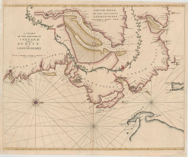
This chart depicts the coastline from Dublin, Ireland to Londonderry, Northern Ireland. The coasts are well defined, with many place names, anchorages, soundings, and rocks depicted. North is oriented to the right, with the Mull of Galloway, the southern-most point in Scotland, appearing at bottom right. The interior of Ireland is filled with a large inset showing the navigable passage to Londonderry through Lough Foyle, the estuary of the river Foyle.
References: Shirley (BL Atlases) M.M&P-1a #14.
Condition: B+
A nice impression and color with minor soiling and light toning along centerfold at bottom. There are some small holes, primarily in blank areas of map, that have been professionally repaired, with the loss of only a tiny amount of rhumb lines at far right.