Catalog Archive
Auction 149, Lot 418

"Das Under Buch Beschreibung Engellandts und Schottlandts", Munster, Sebastian
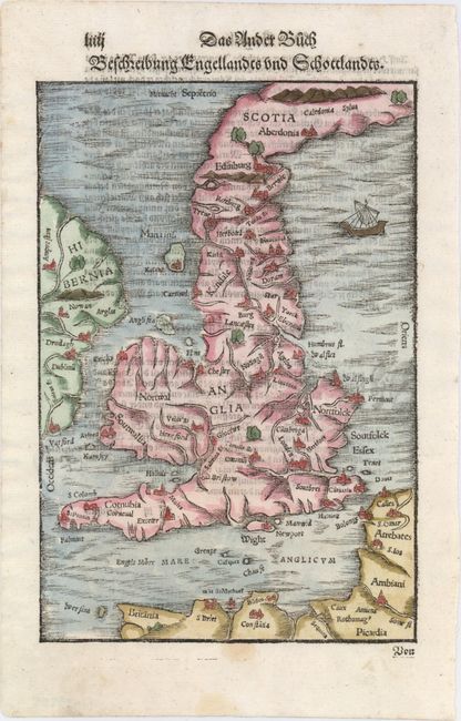
Subject: Britain

Period: 1578 (circa)

Publication: Cosmographia

Color: Hand Color

Size:
6.8 x 9.8 inches
17.3 x 24.9 cm
Download High Resolution Image
(or just click on image to launch the Zoom viewer)

This charming woodblock map of Britain is based on the Mercator-Ortelius outline and focuses primarily on England and Wales as the northern part of Scotland and the western part of Ireland are cut off by the borders. The map shows an unusual eastward slant to the mainland of Scotland. Only major cities are located and the topography is simplified. A small ship sails in the North Sea. German text on verso.

References: Shirley (MCC-94) #149, plt. 32; Shirley (BI to 1650) #122.

Condition: A

A nice example with a faint stain along bottom neatline.

Estimate: $200 - $230

Sold for: $150

Closed on 5/21/2014

Archived