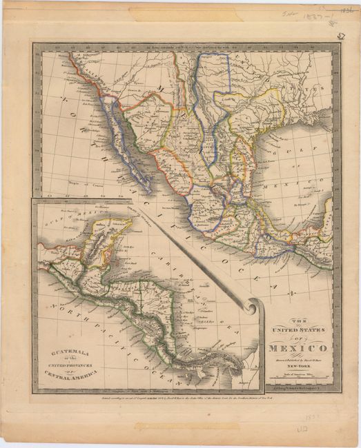
Subject: Southern United States & Mexico, Texas
Period: 1837 (dated)
Publication: New Universal Atlas
Color: Hand Color
Size:
10.6 x 12.1 inches
26.9 x 30.7 cm
This map shows Mexico the year after Texas became independent, and was issued a few short years after the first edition published in 1835. The small Texas configuration is prominently shown, including the towns of San Antonio and San Felippe de Austin. Little Rock, here labeled Arkopolis, is identified as well as Sante Fe, Albuquerque and Taos. The map extends south from New California to the Yucatan with a large inset entitled Guatemala or the United Provinces of Central America.
References:
Condition: B+
Original outline color with light toning and just a few tiny spots of foxing. Tape remnants (removed) in top and bottom blank margins, away from the map image.