Subject: Texas
Period: 1879-87 (dated)
Publication:
Color: Hand Color
Size:
21.3 x 14.4 inches
54.1 x 36.6 cm
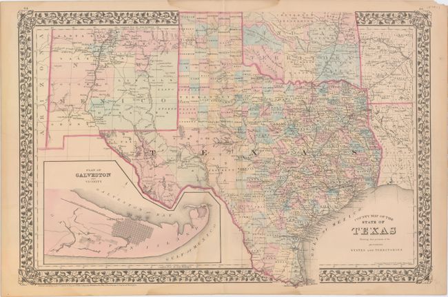
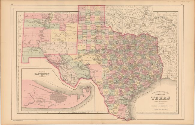
This lot includes two double-page maps of Texas showing the growth of the state over a nine-year period. The maps present an excellent view of the county development with only the large regions of West Texas yet to be organized. Galveston’s role as a main port of entry is obvious as it is depicted in a large inset. The Llano Estacado, or Staked Plain, is shown extending from the New Mexico Territory through the Texas panhandle. In the later map, the railroad network has extended its reach to El Paso and Laredo.
A. County Map of the State of Texas Showing Also Portions of the Adjoining States and Territories, by Samuel Augustus Mitchell, dated 1879. Condition: Original color with a 2" wide faint damp stain along the centerfold with light toning along the sheet edges. (B)
B. County Map of the State of Texas Showing Also Portions of the Adjoining States and Territories, by William M. Bradley & Bros., dated 1887. Condition: Attractive original color with just a few tiny edge tears confined to the blank margins. (A)
References:
Condition:
See description above.