Subject: Western Hemisphere, Franklinia
Period: 1845 (circa)
Publication: A Complete Course Of Geography...
Color: Hand Color
Size:
16.9 x 13.5 inches
42.9 x 34.3 cm
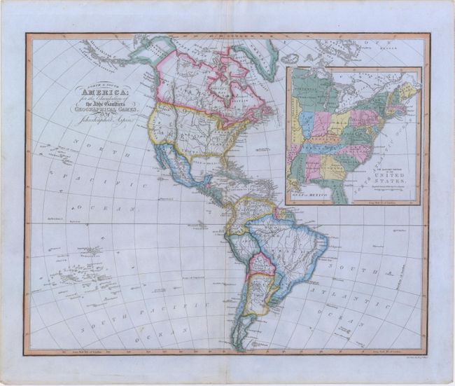
This is a very unusual and interesting map of the Western Hemisphere with a large inset of the United States, engraved for the "Geographical Games." The large inset shows the eastern United States, which extends to just beyond the Mississippi River. This inset gives a very late depiction of the proposed state of Franklinia. In 1785, settlers in western North Carolina and what would become eastern Tennessee organized a state government to be named in honor of Benjamin Franklin. Congress turned down their appeal but the state maintained a legislature and governor until 1788. This ephemeral state appears on only a small number of maps and this is a late appearance of this frontier political experiment. This scarce map was not included in Baynton-Williams' Map Collector article, "Maps marking the American State of Franklin," (TMC-72, pp12). Engraved by Hewitt.
References:
Condition: A
Very nice example on blue paper with a strong impression, coloring, and full margins. There are a few small spots within the image.