Subject: Australia, East Indies
Period: 1797-1847 (dated)
Publication:
Color:
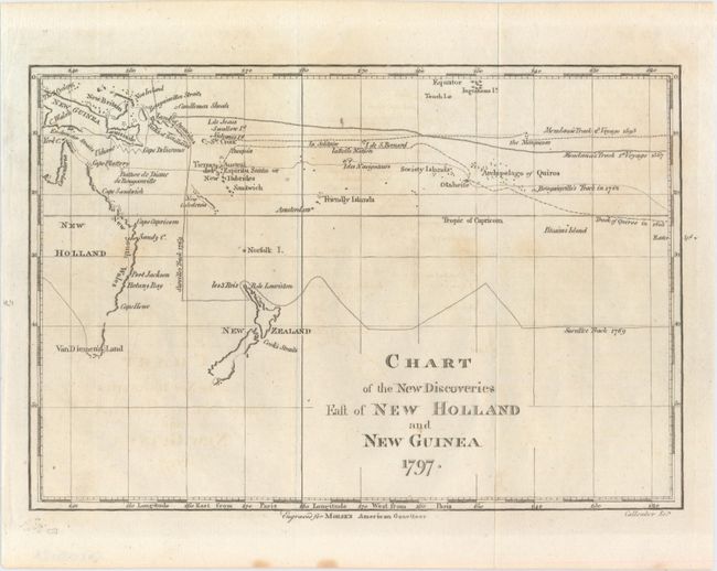
A. Chart of the New Discoveries East of New Holland and New Guinea, by Jedidiah Morse, from Morse's American Gazetteer, dated 1797, black & white (9.7 x 6.5"). This is a small map covering Australia, New Zealand and New Guinea. Easter Island appears at the far right of the map. While the map shows the discoveries made by Captain Cook, it does not show his exploration route. The tracks of other explorers from 1595 to 1769 are traced. Van Diemen's Land (now Tasmania) is shown attached to New Holland (Australia) which was thought to be attached to the mainland until Matthew Flinders and George Bass circumnavigated it in 1798-99. Engraved by Benjamin Callender, Jr. Condition: Issued folding on watermarked paper with faint offsetting and a few minor spots. (B+)
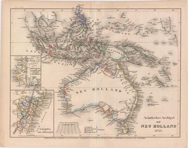
B. Asiatischer Archipel und Neu Holland, by Hildburghausen Bibliographisches Institut, dated 1847, hand color (10.6 x 8.0"). Covers Australia and the East Indies with insets of New South Wales and Western Australia. The map is colored to show the claims of England, the Netherlands, Spain and Portugal. Condition: There is a faint damp stain along the centerfold, else fine. (A)
References: Wheat & Brun #911.
Condition:
See descriptions above.