Subject: Western Hemisphere
Period: 1794 (dated)
Publication:
Color: Hand Color
Size:
46.8 x 40.5 inches
118.9 x 102.9 cm
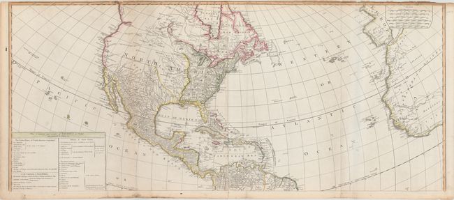
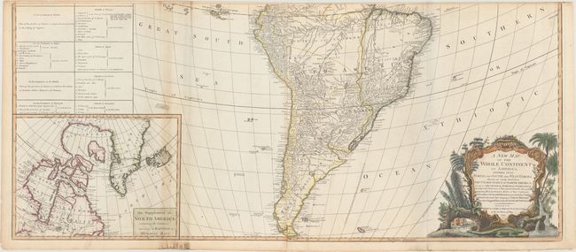
An impressive, four-sheet map of North and South America, originally drawn by John Gibson in 1763 with a slightly different title. The map went through several revisions; this being the final state. The huge map is filled with incredible detail and is based on D'Anville's cartography, as well as Spanish explorations on the west coast of North America and the journals of Governor Pownall in New England and Canada. The new United States is shown with its boundary on the Mississippi River. In the west are two possible locations for a River of the West; one with its source at Pike's Lake, the other further north at Lake Winnipeg. A Chinese colony, Fou Sang is shown in present-day British Columbia. At lower left is an inset map of Hudson and Baffin's Bay. Above the inset is a large text panel listing of the states and the colonial possessions of the various European powers. The baroque style title cartouche features a beaver, a crocodile, an Indian headdress amid trees, a waterfall and tropical flora. The left and right sheets have been joined creating a northern and southern pair (each 46.8 x 20.3").
References: Tooley (America) p. 52, #3.f; McGuirk #112.
Condition: B+
An attractive example on sturdy sheets of watermarked paper with narrow top margins, a few misfolds and light toning along one fold. Occasional light soil and edge chips in the blank margins.