Subject: New Guinea
Period: 1619 (circa)
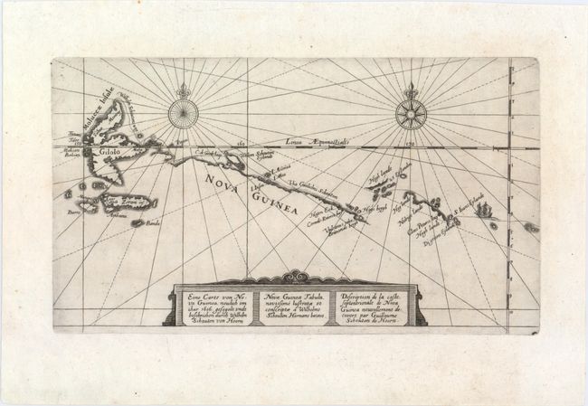
Publication: Historische Beschreibung, der wunderbarlichen Reyse
Color: Black & White
Size:
10.8 x 5.9 inches
27.4 x 15 cm
This interesting map shows the route of Willem Cornelisz Schouten and Jacob le Maire along the northern coast of New Guinea and through the Spice Islands. The main purpose of the voyage was to search for Terra Australis, which eluded them, and to discover a new route to the Pacific and the riches of the Spice Islands. They discovered Le Maire Strait and rounded Cape Horn, which Schouten named for his birthplace, the Dutch city of Hoorn. The map is embellished with two compass roses, a tiny ship, and a strapwork title cartouche in German, Latin and French. This map was published in Volume XI of De Bry's Grand Voyages, Historische Beschreibung, der wunderbarlichen Reyse, welche von einem Holländer, Willhelm Schouten…, first published in 1619.
References:
Condition: A
A strong impression with just a hint of toning and one minute worm hole only visible when held to light.