Subject: Japan & Korea
Period: 1595 (dated)
Publication: Theatrum Orbis Terrarum
Color: Hand Color
Size:
19 x 14.1 inches
48.3 x 35.8 cm
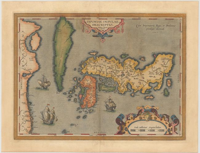
This landmark map was the first map of Japan published in a European atlas. Ortelius received the map from Ludovico Teixeira, a Portuguese Jesuit cartographer and mathematician. While Teixeira had not personally traveled to Japan, he obviously had access to Japanese sources as the map presents the first reasonably accurate and recognizable depiction of the island nation with numerous Japanese place names. Korea appears as an island tapering to a point labeled Punta dos ladrones. The map is elegantly embellished with three large galleons, two elaborate cartouches and a boldly engraved border. This influential map was to become the basis for many other cartographers' maps of Japan for more than fifty years. Italian text on verso with page number 119, published between 1608-12.
References: Van den Broecke #165; Walter OAG #5, plt. 19.
Condition: B
Lovely original color with light soiling and professional repairs to a 2" tear in the sea just west of Korea and two 1" cracks in Korea, caused by the oxidation of the green pigment. One small worm hole above scale of miles cartouche has also been professionally infilled. Margins have been extended at right, left and bottom to accommodate framing.