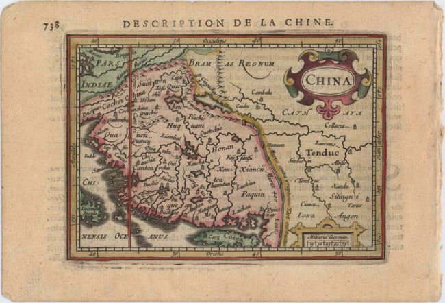
Subject: China & Korea
Period: 1618 (published)
Publication: Tabularum Geographicarum Contractarum…
Color: Hand Color
Size:
5.3 x 3.8 inches
13.5 x 9.7 cm
This miniature map of China is oriented with north to the right, following after Ortelius. Rivers and small towns fill the interior, and there are six coastal provinces and nine inland ones. The Great Wall is prominently shown; unlike Ortelius's map, it is on a plain, not amongst mountains. The map extends to include Korea in island form and Luconia Insula, which is most likely Luzon. Embellished with two strapwork cartouches. French text on verso.
References: Caboara #15; King (2nd ed.) pp. 96-99; Van der Krogt (Vol. III) #8410:342.
Condition: A
A fine impression with minor show-through of text on verso.