Catalog Archive
Auction 148, Lot 634

"A New & Accurate Map of Persia, with the Adjacent Countries. Drawn from the Most Approved Modern Maps &c. The Whole Being Regulated by Astronl. Observations", Bowen, Emanuel

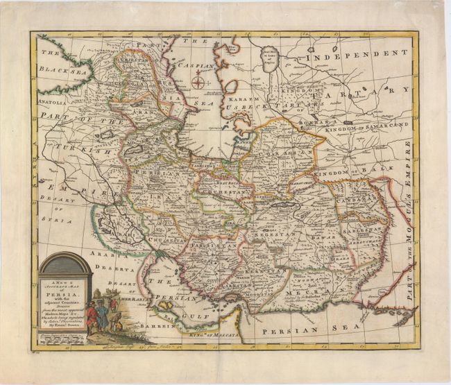
Subject: Persia - Iran

Period: 1747 (circa)

Publication: A Complete System of Geography...

Color: Hand Color

Size:
16.6 x 13.6 inches
42.2 x 34.5 cm
Download High Resolution Image
(or just click on image to launch the Zoom viewer)

This fine map of the Persian Empire is packed with detail of the topography, cities, towns and roads. It covers the region from the Caucasus through present-day Afghanistan, Iraq and Iran. Decorated with a pictorial title cartouche and a small compass rose.

References: Shirley (BL Atlases) T.BOW-2a #39.

Condition: B+

Watermarked paper with archivally repaired centerfold separations at top and bottom, a few faint stains, and a 1/2" tear just south of Maragheh (<i>Maragha</i>) that has been professionally repaired.

Estimate: $220 - $250

Unsold

Closed on 2/19/2014

Archived