Catalog Archive
Auction 148, Lot 602

"Carte de la Turquie de l'Arabie et de la Perse Dressee sur les Memoires les Plus Recens Rectifiez par les Observations de Mrs. de l'Academie Royle. des Sciences", Delisle/Covens & Mortier

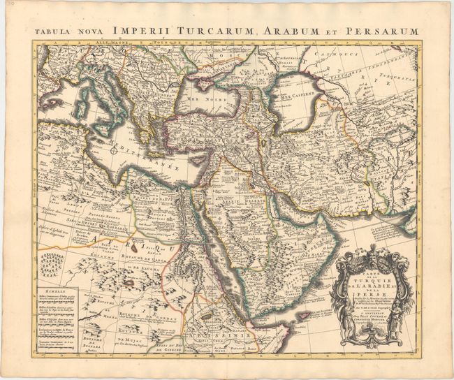
Subject: Near & Middle East

Period: 1730 (circa)

Publication:

Color: Hand Color

Size:
22.6 x 18.4 inches
57.4 x 46.7 cm
Download High Resolution Image
(or just click on image to launch the Zoom viewer)

Superb map of the Ottoman Empire stretching from the Balkans through present-day Turkmenistan in the north and including Northeastern Africa and the Arabian Peninsula. The map is boldly engraved, packed with information and decorated with a fine title cartouche. Delisle's maps of the Middle East were some of the most accurate early maps published until the end of the 18th century.

References: Ankary #139; Tibbetts #229.

Condition: A+

A fine impression with original color and a hint of toning along sheet edges.

Estimate: $400 - $475

Sold for: $300

Closed on 2/19/2014

Archived