Subject: Southern Europe
Period: 1719 (circa)
Publication:
Color: Hand Color
Size:
21.9 x 19.1 inches
55.6 x 48.5 cm
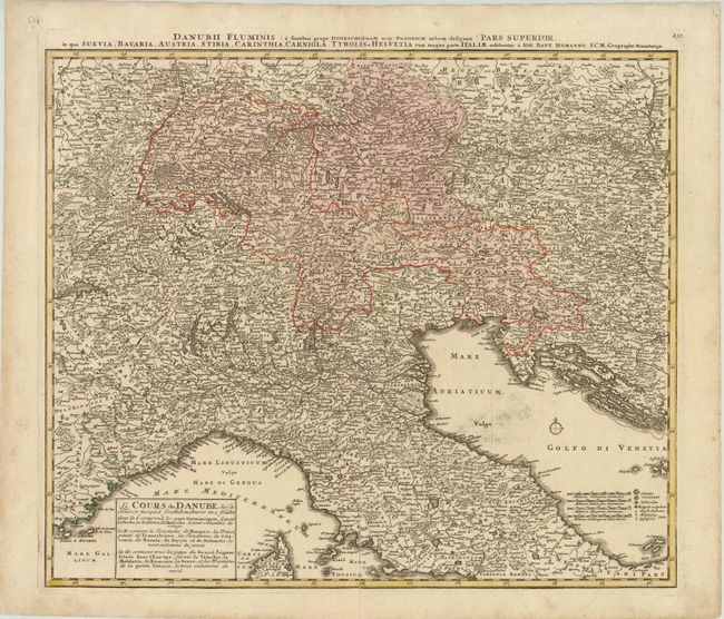
This map details the course of the Danube and covers parts of northern Italy, Switzerland, Bavaria, Austria, Tyrol, Carinthia, Balkins, and Monrovia. Extends west to St. Tropez, north to Nuremberg, east to Wein and Canischa, and south to Rome. As the title cartouche indicates, the course of the Danube is "illuminated in red." A legend identifies towns of various sizes, universities, and Archbishoprics. Latin title above map: Danubii Fluminis (a Fontibus Prope Doneschingam usqe Posonium urbem Designati) Pars Superior, in qua Suevia, Bavaria, Austria, Stiria, Carinthia, Carniola, Tyrolis et Helvetia cum magna parte Italiae Exhibentur…
References:
Condition: B+
A nice impression with original color and a bit of printer's ink residue in the Adriatic Sea. The map was separated along the centerfold, and has been professionally repaired.