Subject: Eastern Europe
Period: 1773 (dated)
Publication:
Color: Hand Color
Size:
20.1 x 17.3 inches
51.1 x 43.9 cm
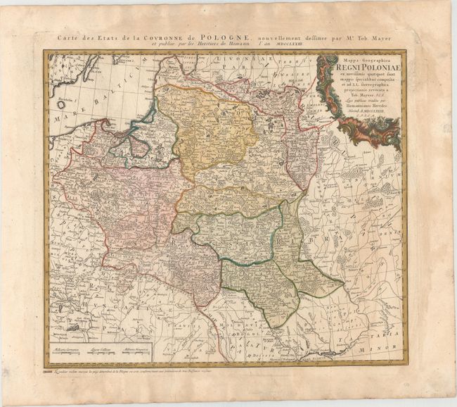
This map of the Polish-Lithuanian Commonwealth was published just one year after the First Partition of Poland. A note below the map indicates that areas marked in "violet" were seized by the "three neighboring powers" in 1772. After the reign of Augustus III (1696-1763) weakened the Commonwealth, the Russian Empire, the Kingdom of Prussia and Habsburg Austria decided upon partitions of the Commonwealth, and simultaneously sent troops to occupy the newly annexed territories. The Commonwealth was unable to protect the occupied provinces, and ultimately lost 30% of its overall territory in the partition. The title cartouche attributes the map to Johann Tobias Mayer, whose detailed map of the Polish Empire was based on Barnikel's map of Curland (1747) and Jan Nieprzecki's map of Lithuania (1749). Poland extends along the Baltic coastline from Riga to Gdansk and stretches southeast to include much of present-day Romania and Ukraine. Topographical information is very good and there is a wealth of information on towns, rivers, lakes, forests and political divisions. French title is outside top border: Carte des Etats de la Couronne de Pologne, Nouvellement dessinee par Mr. Tob. Mayer...
References: Malinowski (MCC-25) #151.
Condition: B+
Watermarked paper with original color that has been partially refreshed. There is light toning and some printer's ink residue.