Subject: Central Europe
Period: 1870 (circa)
Publication:
Color: Printed Color
Size:
60 x 58 inches
152.4 x 147.3 cm
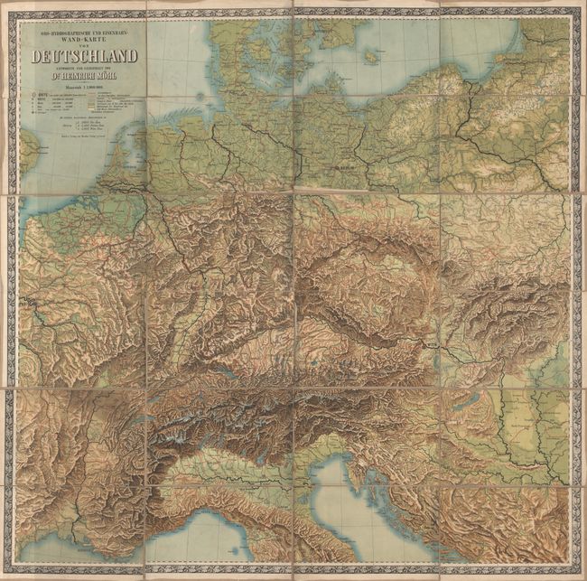
This giant folding map extends from Copenhagen in the north to Toulouse and Florence in the south, and from Paris in the west to Warsaw in the east. Red lines criss-crossing the map depict the extensive system of railroads throughout central Europe, with red dashed lines denoting rail lines under construction. The various towns and cities identified in the map are limited to those that fall on or near railroad lines. A secondary purpose of the map is to show the relation of the mountains to drainage and water sheds in the region. The topography of the land is graphically depicted and the size of the rivers is indicated through the width of the black lines. Surrounded in a decorative border with oak leaves and acorns. Created by Dr. Heinrich Mohl and printed by Theodor Fischer in Kassel. Dissected and backed in linen.
References:
Condition: B
Brightly colored with light soiling and a few small abrasions at the top of the map. The dissected sections are detaching from the linen, and some of the sections have a tendency to stick together when folded, but they are fairly easily separated without causing damage.