Subject: France
Period: 1856 (dated)
Publication: Atlas National Illustre
Color: Hand Color
Size:
21 x 23 inches
53.3 x 58.4 cm
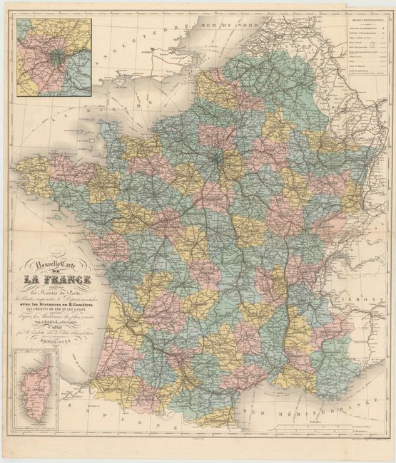
This intensely detailed map of France shows all major cities, towns, harbors, roads, railroads, rivers and canals. The map includes the southern coast of England and the English Channel (Pas de Calais) and depicts sea routes and mileages in kilometers from London, Dover and Southampton to the northern coast of France. In the Mediterranean, sea routes with mileages are depicted from France to Barcelona, Alger, Ajaccio, and Genoa (Genes). Two detailed inset maps of Paris and its environs and Corsica fill the corners. At top right is a legend identifying various sizes of towns and types of routes. Jean Baptiste-Louis Charle was a prominent French Geographer in the mid-19th century and his map was included in Victor Levasseur's Atlas National Illustre de France in 1856.
References:
Condition: B+
Issued folding with original color, one short fold separation that has been closed on verso with archival tape, and minor toning along one fold. There are a couple of minute worm holes only visible when held to light, and a binding trim at top right with a 1/4" binding tear that has also been closed with archival tape.