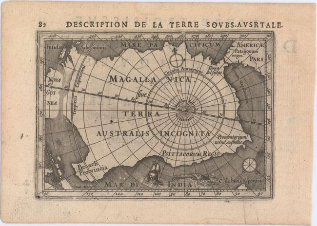
Subject: South Pole
Period: 1618 (published)
Publication: Tabularum Geographicarum Contractarum…
Color: Black & White
Size:
5.3 x 3.8 inches
13.5 x 9.7 cm
This handsome miniature map is one of the first to focus solely on the South Pole. It depicts a large Magallanica Sive Terra Australis Incognita incorporating Terra del Fuogo, Beach Provincia, Psittacorum Regio, and Promontorium Terrae Australis. The large landmass is separated from South America by the Strait of Magellan, and almost joined to Nova Guinea, with the Salomon Islands depicted nearby. The map is handsomely adorned with a fierce sea monster, a sailing ship, and two compass roses orienting north away from the South Pole. French title page on verso.
References: King (2nd ed.) pp. 96-99; Koeman (Vol. III) #0030:342; Tooley (MCC-2) #12.
Condition: A
A nice impression on watermarked paper with minor marginal soiling and light text show-through.