Subject: Western Scotland
Period: 1654 (circa)
Publication:
Color: Hand Color
Size:
21.3 x 16.8 inches
54.1 x 42.7 cm
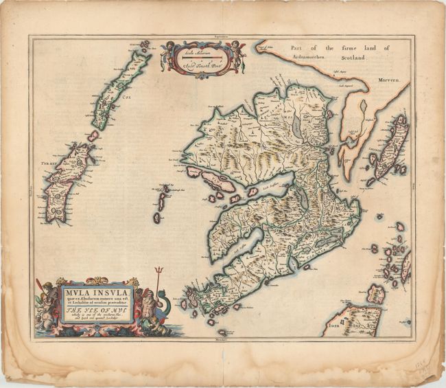
This lovely map shows the Isle of Mull off the western coast of Scotland, and includes many of the smaller islands nearby including Coll, Tiree, and the northern portion of Jura. There is good detail of the rivers, cities, villages, and topography. The map includes two decorative cartouches, one flanked by putti holding fish that encloses the distance scale, and another for the title that is surrounded by Neptune and his entourage. Blaeu's rendering is based on the work of Timothy Pont, who conducted an important survey of Scotland in the late sixteenth century. Dutch text on verso, from an edition published from 1654 to 1662.
References: Van der Krogt (Vol. II) #5871:2.
Condition: B+
This example has attractive color and ample margins, with some faint staining, minor show-through of text on verso, and centerfold separations in top and bottom blank margins that have been closed on verso. There are damp stains in the blank margins.