Subject: Scotland
Period: 1758-90 (circa)
Publication:
Color: Hand Color
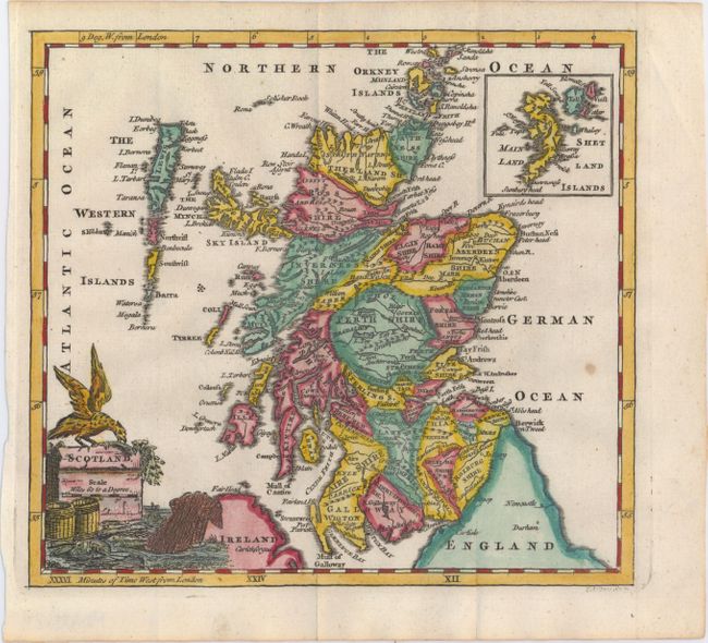
A. Scotland, by Thomas Jefferys, circa 1758 (7.8 x 7.2"). This map divides Scotland into shires, and shows towns, rivers, and mountains. There is an inset of the Shetland Islands in the upper right corner and a lovely title cartouche featuring a majestic bird, fish, and two barrels. Condition: Issued folding with one small faint spot in an unengraved area at right. (A)
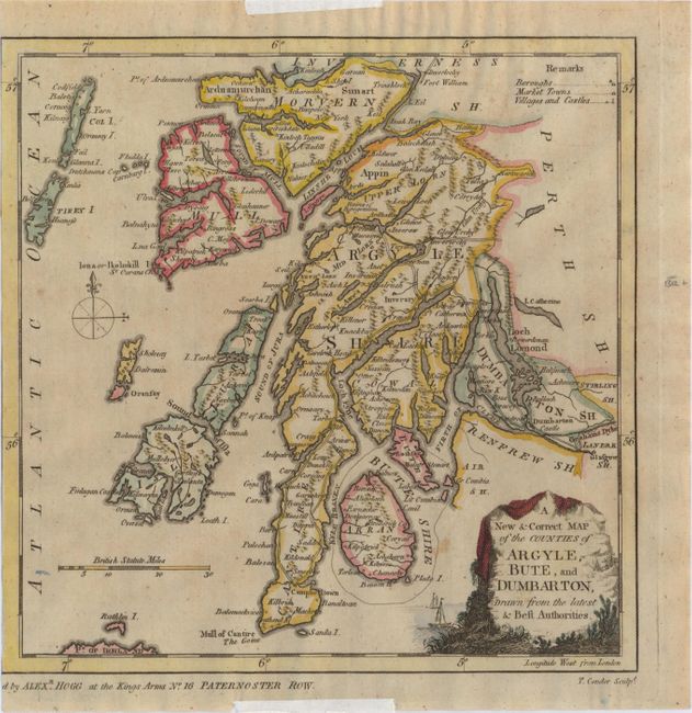
B. A New & Correct Map of the Counties of Argyle, Bute, and Dumbarton, Drawn from the Latest & Best Authorities, by Thomas Conder, circa 1790 (8.4 x 8.4"). This is the larger part of a sheet with two maps. It depicts the region from Glasgow north to Inverness, and shows basic detail of towns, villages, castles and topography. The map adorned by a decorative title cartouche. Published by Alexander Hogg at No. 16 Paternoster Row. Condition: A nice impression on a slightly toned sheet with the neatline missing at left from where the map was separated from the larger sheet. There is some faint scattered foxing and two pieces of hinge tape on recto in the blank margins. (B)
References:
Condition:
See description above.