Subject: England & Wales
Period: 1720 (circa)
Publication:
Color: Black & White
Size:
14.2 x 11.9 inches
36.1 x 30.2 cm
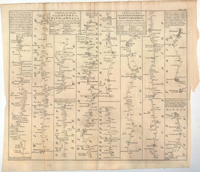
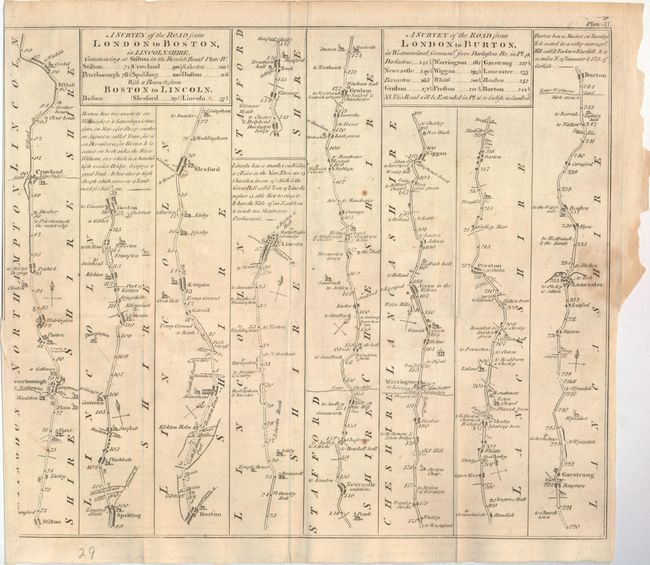
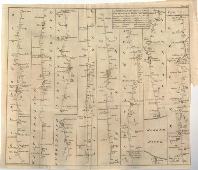
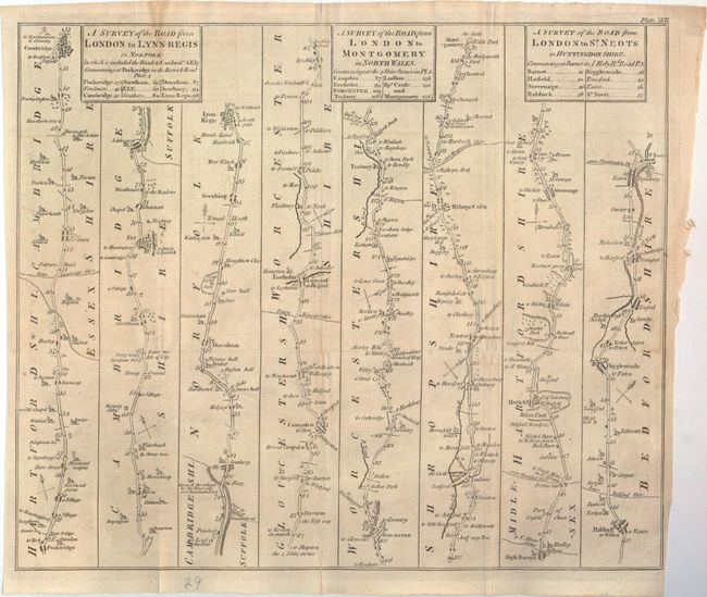
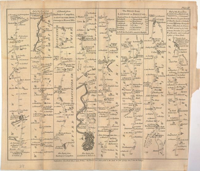
This large lot of strip road maps are based upon the surveys contained in John Ogilby's Brittania, first published in 1675. This edition is slightly reduced, but larger than the editions by Thomas Gardner (1719), John Senex (1720), and Bowen & Owen (1720), which were more conducive for the traveler. Each of the sheets contain plate numbers at top right with the following titles:
A. Survey of the Roads from London to Bath and Wells...[on sheet with]…from Ferrybridge to Boroughbridge...
B. A Survey of the Road from London to Boston...[on sheet with]...London to Burton...
C. A Survey of the Road from London to Flamborough Head...
D. A Survey of the Road from London to Lynn-Regis...[on sheet with]...London to Montgomery...[on sheet with]...London to St. Neots...
E. The Road from London to Bristol...
F. The Road from London to the 145th Mile-stone in the way to Berwick
G. The Continuation of the Road from London to the Lands End...[on sheet with]…Plymouth to Dartmouth...[on sheet with]…London to New Haven…
H. The Continuation of the Road from London to Holy Head…[on sheet with] The Road from London to Northampton…
I. The Road from London to Barnstable…[on sheet with]…Barnstable to the 73 Mile Stone in the Way to Truro…
J. A Survey of the Road from London to Norwich…[on sheet with]…London to Okeham…
K. A Survey of the Road from London to Richmond…[on sheet with]…London to Alresford…
L. The Continuation of the Road from London to Southampton…[on sheet with]…London to Pool…[on sheet with]…London to Shrewsbury…
M. Continuation of the Road from Shrewsbury to Welshpool...[on sheet with]…London to Wells...[on sheet with]…London to Weymouth…
N. A Survey of the Roads from Chelmsford in Essex to St. Ed. Bury...[on sheet with]…Chelmsford to Malden and Raleigh…
O. A Survey of the Road from Chester to Cardif...[on sheet with]…Dartmouth to Minehead…
P. A Survey of the Road from St. Davids to Holywell…
Q. A Survey of the Road from Exeter to Barnstable...[on sheet with]…Exeter to Dorchester...[on sheet with]…Glocester to Coventry...[on sheet with]…Glocester to Hereford…
R. A Survey of the Road from WelshPool to Carnarvan...[on sheet with]…Whitby to Durham...
Size varies slightly. Images representative of lot.
References:
Condition: B
Issued folding on watermarked paper and now flattened with several short fold separations and binding tears that have been repaired on verso with archival tape and old paper. The maps have light offsetting, occasional toning along the folds, and a few scattered small stains.