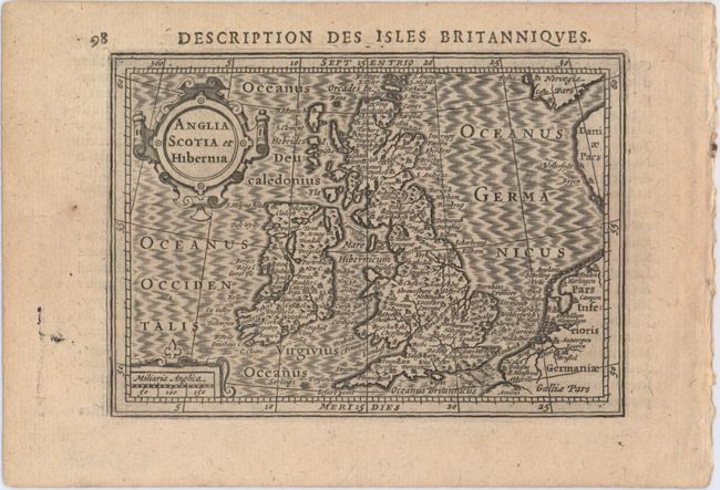
Subject: Britain
Period: 1618 (published)
Publication: Tabularum Geographicarum Contractarum…
Color: Black & White
Size:
5.3 x 3.8 inches
13.5 x 9.7 cm
This handsome miniature map depicts the British Isles and is filled with place names. The map extends to show parts of Belgium, the Netherlands, Denmark, and Norway. While the majority of the maps for Bertius' geographical treatise were engraved by Jodocus Hondius Jr. after Mercator, the individual maps of England, Scotland and Ireland were engraved by Salomon Rogiers after John Speed. Adorned with two strapwork cartouches and a moire-patterned sea. French text on verso.
References: Shirley (BI to 1650) #347; King (2nd ed.) pp. 96-99; Van der Krogt (Vol. III) #5000:342.
Condition: A
A fine impression on watermarked paper.