Subject: North Pole
Period: 1714 (dated)
Publication:
Color: Hand Color
Size:
17.8 x 17.9 inches
45.2 x 45.5 cm
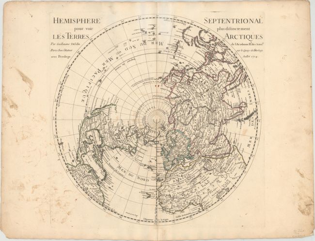
This is the first edition of this important map of the Northern Hemisphere, drawn with Delisle’s characteristic scientific approach. This is the first map to correctly place the west coast of North America, moving it substantially east from previous mapping. California is shown as a peninsula at a time when it was often still shown as an island, even in other maps drawn by Delisle, although a dotted line still hints at the possibility of the island form. Near the northern coast of Asia is Terre de la Compagnie with a note about its discovery by Jean de Gama. Delisle based his depiction of the Northern Pacific on the voyage of Fondant in 1709.
References: Wagner #504.
Condition: B
On watermarked paper with ample margins. There is light soiling and a few small scattered stains within the map image.