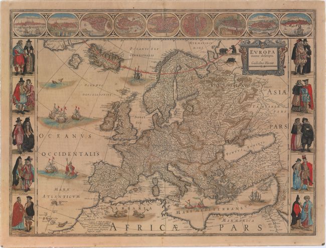
Subject: Europe
Period: 1643 (circa)
Publication: Theatre du Monde ou Nouvel Atlas
Color: Hand Color
Size:
21.9 x 16.2 inches
55.6 x 41.1 cm
This classic map of Europe is presented in the carte-de-figures style with vignettes on three sides. The upper frieze has nine bird's-eye views of Amsterdam, Prague, Constantinople, Venice, Rome, Paris, London, Toledo and Lisbon. The side borders contain the costumes of the noblemen and women of ten European nations. The map is embellished with sailing ships, sea monsters, bears, and Neptune riding a dolphin and holding his trident. A beautiful map produced at the height of the Golden Age of Dutch mapmaking; it was included in the first volume of Blaeu's magnificent atlas. French text on verso.
References: Goss (Blaeu) #4, p.30; Van der Krogt (Vol. II) #1000:2.
Condition: B
Old color with moderate toning, a centerfold separation entering 0.75" into neatline at top that has been closed on verso with archival materials, and a few small abrasions. There is also an edge tear entering about 0.5" into image at top as well as a crack in the carte-a-figure border at left, both of which have been archivally repaired.