Subject: North Atlantic
Period: 1804 (dated)
Publication:
Color: Hand Color
Size:
35.7 x 22.9 inches
90.7 x 58.2 cm
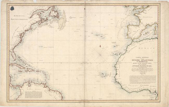
This large, uncommon Spanish chart by Antonio Cornel centers on the Atlantic Ocean north of the equator. The left side of the chart spans from Labrador down to the northern part of South America while the right side covers from the southern tip of Ireland to the Gulf of Guinea off the coast of Africa. Although the inland areas are largely left blank, there is good coastal detail, with ports, waterways, and soundings identified. Hazards and various notes appear across the ocean, and fishing banks are marked off the coast of Canada. The seal of the Deposito Hidrografico can be found in the upper left corner. Engraved by Fernando Selma.
References:
Condition: B
A crisp impression with light soiling, pencil markings along the European and African coasts, and several short centerfold separations that have been closed on verso with archival tape. There are a few small chips in the top blank margin and a tear entering 5.25" into the image at left that has been repaired on verso with archival materials.