Catalog Archive
Auction 148, Lot 440

NO RESERVE

"Carte Reduite de l'Ocean Occidental, Contenant les Cotes Occidentales de l'Europe et de l'Afrique, et les Cotes Orientales de l'Amerique...", Buy de Mornas, Claude

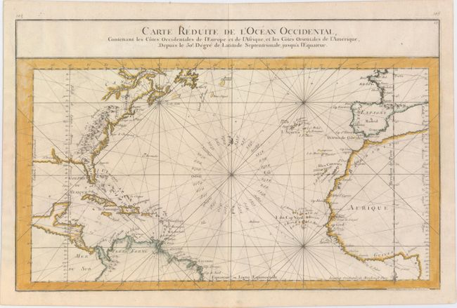
Subject: North Atlantic

Period: 1761 (circa)

Publication: Atlas Methodique et Elementaire de Geographie et d'Histoire

Color: Hand Color

Size:
17.9 x 11.4 inches
45.5 x 29 cm
Download High Resolution Image
(or just click on image to launch the Zoom viewer)

This beautifully engraved chart shows the Atlantic Ocean north of the equator, delineated with rhumb lines. A good portion of each of the continents is shown with major port cities identified, including New Orleans. In North America the Appalachian Mountains are depicted extending south to Florida and the colonies of Carolina, Virginia, New York, and New England are named. The coastline of the colonial United States is rendered as a series of peninsulas. The map includes two fleurs-de-lis. Engraved by Le Roy.

References:

Condition: B+

On watermarked paper with minor offsetting and a few scattered faint spots.

Estimate: $250 - $350

Unsold

Closed on 2/19/2014

Archived