Subject: Lima & Callao, Peru
Period: 1713-70 (circa)
Publication:
Color: Hand Color
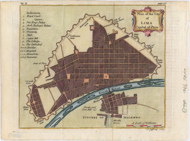
A. Plan of the City of Lima Capital of Peru, by Thomas Jefferys, circa 1770 (6.7 x 5.6"). A lovely bird's-eye plan of the city of Lima with a numbered key at left identifying numerous locations on the map including churches, hospitals, monasteries, palaces, the university, a copper mill, and the cathedral. Condition: Issued folding, with a hint of offsetting from an opposing text page.
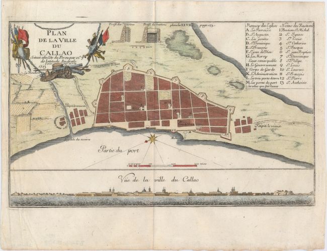
B. Plan de la Ville du Callao Scituee ala Cote du Perou par 12 7 de Latitude Australe, by Frezier, dated 1713 (11.4 x 6.9"). This bird's-eye plan of Callao includes a lettered key identifying various churches and a numbered key naming the bastions fortifying the city. Below the plan is a land approach view of the port city. The cartouche is surrounded by flags, cannons, shields, and other weaponry. A compass rose orients north to the bottom left. Condition: Watermarked paper with attractive color.
References:
Condition: A
See description above.