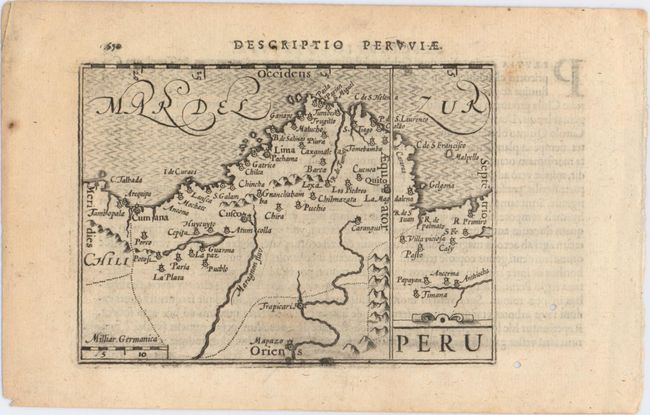
Subject: Peru
Period: 1606 (published)
Publication: Tabularum Geographicarum Contractarum
Color: Black & White
Size:
4.9 x 3.5 inches
12.4 x 8.9 cm
An interesting miniature map of Peru oriented with north at right, and extending into Ecuador, Bolivia and Chile. Major cities and villages are noted, including Quito, Lima, Cusco and La Paz. A simple strapwork cartouche and moire-patterned sea adorn the map. Latin text on verso. This map was originally published in Cornelis Claesz' Map-Treasury, with maps engraved by Jodocus Hondius and Pieter van den Keere.
References: Van der Krogt (Vol. III) #9820:341; King (2nd Edition) pp. 80-82.
Condition: A
There is some printer's ink residue at bottom of map and two small worm holes in right blank margin, not affecting image.