Subject: French Guiana and Northeastern Brazil
Period: 1763 (dated)
Publication:
Color: Hand Color
Size:
18.1 x 14.6 inches
46 x 37.1 cm
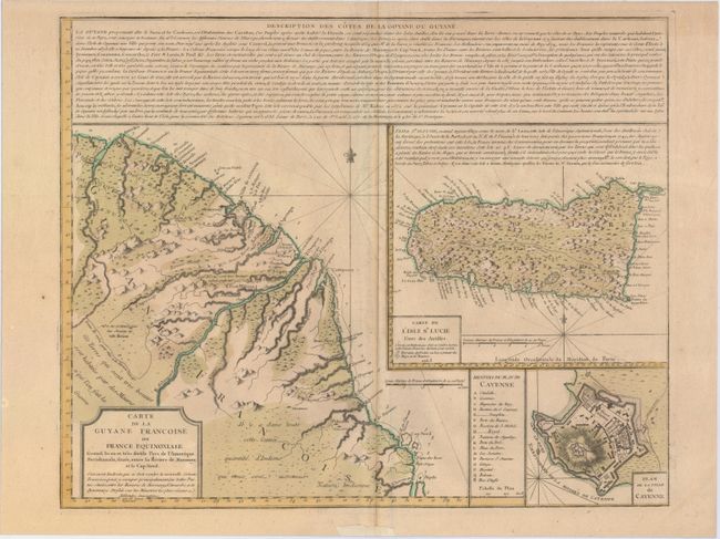
This scarce and handsome map depicts the coastline between the Maroni River along the western border of French Guiana to the Araguari River, just north of the Amazon River. There is good detail of the rivers, mountains, and settlements in the region. There are several notations regarding the quality of the land and the location of Native Indians, including one that explains that "this land is very good and is inhabited by the Maures, with whom we are at war." At right are large insets of St. Lucia, incorrectly oriented with the northern end of the island pointing west, and a bird's-eye plan of the city of Cayenne with numerous locations identified by a lettered key. An extensive description of the region accompanies the map. Below the main title is the imprint of Mr. Beteow, who is not listed in Tooley's Dictionary of Mapmakers.
References:
Condition: B+
Watermarked paper with light toning along centerfold, minor soiling, and a few minute worm holes only visible when held to light.