Catalog Archive
Auction 148, Lot 404

"Carte de l'Isle de Caienne et des Rivieres Voisines...", Anville, Jean Baptiste Bourguignon d'

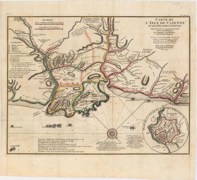
Subject: French Guiana

Period: 1729 (dated)

Publication:

Color: Hand Color

Size:
16.9 x 12.8 inches
42.9 x 32.5 cm
Download High Resolution Image
(or just click on image to launch the Zoom viewer)

Attractive chart of the coast of French Guyana locating the important fortifications and natural harbor of Cayenne. There is excellent detail of rivers, towns, political boundaries, and mountains throughout the area, and soundings are marked in the Atlantic Ocean. Numerous notes are included regarding the terrain and availability of resources, and below the map is a brief history of Cayenne. At bottom right is a an inset with a bird's-eye plan of Fort St. Michael in Cayenne.

References:

Condition: B+

A fine impression with light toning. Issued folding with faint offsetting and a few tiny holes at fold intersections.

Estimate: $200 - $230

Unsold

Closed on 2/19/2014

Archived