Catalog Archive
Auction 148, Lot 390

"Plan du Port et du Carenage de Cariacoua Situe dans la Partie du Sud de l'Isle de St. Vincent", Bellin, Jacques Nicolas

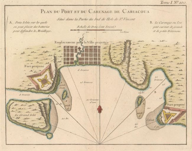
Subject: St. Vincent

Period: 1764 (circa)

Publication: Le Petit Atlas

Color: Hand Color

Size:
8.6 x 6.7 inches
21.8 x 17 cm
Download High Resolution Image
(or just click on image to launch the Zoom viewer)

This attractive bird's-eye plan shows the town of Calliaqua (Cariacoua) at the southern end of St. Vincent. Two "proposed forts" are depicted, as well as soundings, shoals, and a location suitable for anchoring both small and large vessels. The tiny island just south of Young Island, here called Le Grand Islet, later became the location for Fort Duvernette.

References:

Condition: A

A nice impression on watermarked paper with very wide margins, minor offsetting, and one crease along edge of sheet at bottom.

Estimate: $160 - $190

Unsold

Closed on 2/19/2014

Archived