Subject: Curacao
Period: 1728 (circa)
Publication:
Color: Hand Color
Size:
23.3 x 20.6 inches
59.2 x 52.3 cm
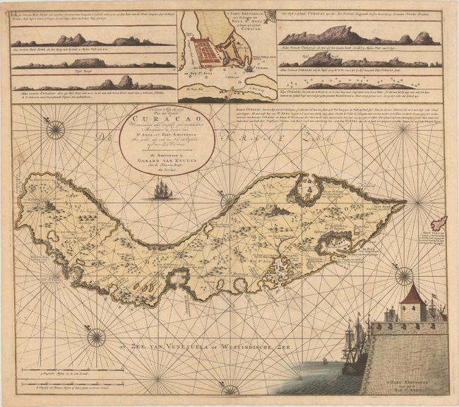
This scarce map is one of the earliest detailed maps of Curacao. Based on Arent Roggeveen's map of the island first published in 1675, Van Keulen closely copied a vignette featuring Fort Amsterdam as well as an inset map with a bird's-eye plan of Fort Amsterdam and the Santa Anna Bay. With north oriented to the top left, Van Keulen updated Roggeveen's map with numerous details along the coastline and the interior of the island. Navigational notes surround Curacao, with additional notations regarding the locations of salt pans, plantations, and landings by the French. Above the map Van Keulen has also included six land approach views of Curacao.
The island of Curacao was the historical nexus of the Netherlands Antilles. With its large and protected natural port, the island was the major center for commerce of the Dutch West India Company. Although first inhabited by the Spanish around 1500, they soon abandoned the island due to its lack of gold and fresh water. In 1634 the Dutch claimed Curacao and began building settlements and plantations. During much of the 17th and 18th centuries, Curacao was the center for the Dutch slave trade in the West Indies.
References: Shirley (BL Atlases) M.KEU-3b #83.
Condition: B+
A nice impression with minor soiling and light toning along centerfold.