Catalog Archive
Auction 148, Lot 379

"Carte de l'Isle de Saint Domingue Dressee en 1722 pour l'Usage du Roy sur les Memoires de Mr. Frezier…", Delisle/Covens & Mortier
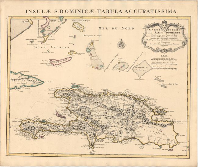
Subject: Hispaniola

Period: 1730 (circa)

Publication:

Color: Hand Color

Size:
24.1 x 18.6 inches
61.2 x 47.2 cm
Download High Resolution Image
(or just click on image to launch the Zoom viewer)

This is an important map of Hispaniola and the Turks & Caicos Islands. When initially published in 1722 by Delisle it was one of the first to depict the island's true contours following Frezier's important map of the island. The chart provides excellent detail of the three districts showing mountains, roads, towns, ports, plantations, sugar works and navigational hazards. Decorated with a large title cartouche and compass rose. Latin title above, "Insulae S. Dominicae Tabula Accuratissima."

References:

Condition: A+

Original color with a hint of toning along sheet edges.

Estimate: $350 - $425

Sold for: $250

Closed on 2/19/2014

Archived