Catalog Archive
Auction 148, Lot 363

Detailed Chart of the Gulf of Mexico Showing Colonial Possessions

"A New General Chart of the West Indies from the Latest Marine Journals and Surveys, Regulated and Ascertained by Astronomical Observations", Sayer & Bennett

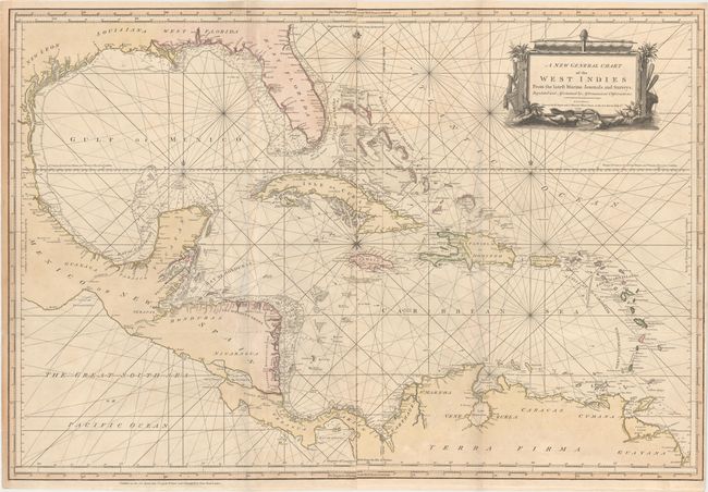
Subject: Gulf of Mexico & Caribbean

Period: 1779 (dated)

Publication:

Color: Hand Color

Size:
40.2 x 27.3 inches
102.1 x 69.3 cm
Download High Resolution Image
(or just click on image to launch the Zoom viewer)

A spectacular, large-scale chart of the Gulf of Mexico, Florida and the Caribbean printed on two separate sheets and joined. The map is extremely detailed, and filled with information on coastal features, soundings, shoals and hazards. It extends to Central America and the northern tip of South America. The colonial possessions are denoted in color: pink for the British, yellow for the Spanish, and green for the French. The title is surrounded with a well-engraved cartouche comprised of items relating to the trade in the region. An uncommon map.

References:

Condition: B+

Issued folding on watermarked paper with original color, archival repairs to a few short fold separations, and very light toning along one fold. There are a few light spots of foxing and minor soiling. Please note that the bluish shadows running vertically along the folds are caused by our scanner, and do not appear on the map itself.

Estimate: $1,700 - $2,000

Sold for: $1,100

Closed on 2/19/2014

Archived