Subject: Gulf of Mexico & Caribbean
Period: 1747 (circa)
Publication: A Complete System of Geography
Color: Black & White
Size:
16.5 x 13.6 inches
41.9 x 34.5 cm
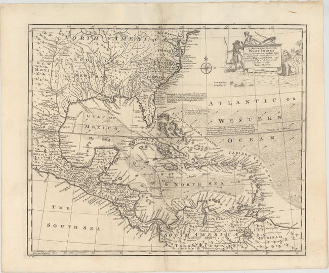
This handsome map covers the southeastern United States, eastern Mexico, Central America, the West Indies, and the northern part of South America. It is derived from Popple's important map of the region. The British colonies in North America are confined east of the Appalachians with France in control of Louisiana. Many early forts and Indian tribal territories are located. There are several interesting notations concerning the history of the region, such as a notation concerning the southern boundary of the Province of Carolina, "so that Fort St. Augustin as well as Georgia falls within these limits." Trade winds and sea routes are marked throughout, including the course of the Spanish gold fleet from Old Spain and the return trip from Cartagena and Vera Cruz. The title cartouche is adorned with Native Americans and an incongruous lion (likely representing the British colonies). This is the second state.
References: Sellers & Van Ee #1682; McCorkle (18th C. Geography Books) #17-38.
Condition: B+
Issued folding, now pressed flat, with minor soiling and light offsetting concentrated along the centerfold, as well as centerfold separations at top and bottom that have been closed on verso with archival materials.