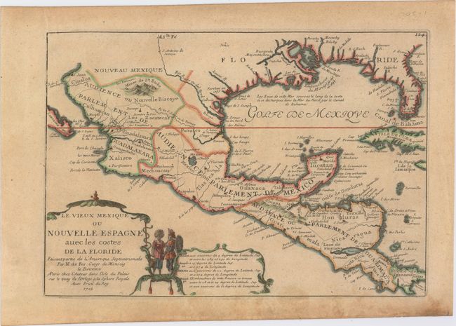
Subject: Gulf of Mexico, Mexico & Central America
Period: 1705 (dated)
Publication: L'Atlas Curieux ou le Monde
Color: Hand Color
Size:
12.8 x 8.8 inches
32.5 x 22.4 cm
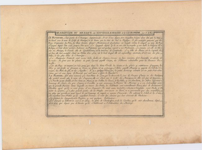
This attractive small map covers the Gulf of Mexico through Central America and includes parts of Cuba and Jamaica. It extends through Mexico to show the southern tip of Baja California. This is an early map to show the correct location of the Mississippi River delta gleaned from the expeditions of La Salle and Iberville. Two French forts are located: LaSalle's Fort St. Louis in Texas (Fortbati en 1685) and another near present-day New Orleans. One of the prominent features in northern Mexico is Les Fameuses Mines de Ste. Barbe, the legendary Santa Barbara mines of the Chihuahua-Durango region. The large cartouche features two native figures. Included with the map is a full page of text describing the region.
References: Pastoureau, FER I [111].
Condition: B+
Watermarked paper with light toning and a small worm track in the dedication cartouche that has been closed on verso with old paper resulting in minimal image loss. There are minor damp stains mostly confined to the lower blank margin.