Subject: Mexico, Exploration
Period: 1829 (published)
Publication:
Color: Black & White
Size:
6 x 9 inches
15.2 x 22.9 cm
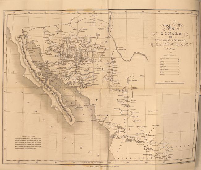
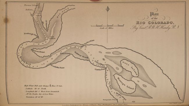
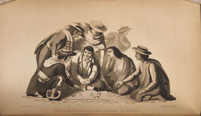
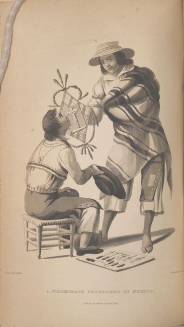
This first edition is a vivid and early portrayal of the culture and geography of northwestern Mexico based on the author's extensive travels in the region. Hardy was in search of pearls in the Gulf of California. The result of his journey is a fascinating book and map on "the little known regions of Senora and Lower California", (Map of Sonora and Gulf of California, 17 x 13"). This scarce map extends from the Gila River in the north to Mexico City. Most of the eastern portion is blank and shows only western towns, including S. Juan del Rio, Guanaxuato, Guadalaxara, Durango, Chihuahua and much of the Rio Grande River. Curiously, the town "Arizona" is shown south of the Gila River in today's New Mexico. Scores of villages are named in the northwest. All of Baja is included with only a few towns -- La Paz, Loreto and Mulege. Legend locates Hardy's route, Ranchos, Gold and Silver Spots, Real di Minas, Mines, Presidio, and Missions. A second map, Plan of the Rio Colorado, by Lieut. R.W.H. Hardy (7.5 x 4.5") is the first American exploration and mapping of the Colorado River from its mouth in the Gulf of California to its confluence with the Gila River. A note claims the high water changes by 22 feet. The six called for plates are present and include: The Game of Monte, in the Streets of Mexico; A Pilgrimage Performed in Mexico; A Mexican Cavallero; Morning Salutations in Mexico; Water Carrier in Mexico; and An Evangelista, or Letter-Writer in the Haza Grande of Mexico. Most descriptions list seven plates, but here we count as a map the Colorado River plate.
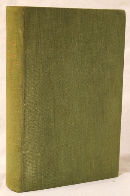
The book is hardbound in green cloth with gilt title on spine. This first edition is complete, 540 pp, two maps and six plates. Published by Henry Colburn and Richard Bentley, London, 1829.
References:
Condition: B+
The map has light offsetting, a 1" binding tear, and a small puncture in a blank area of the map near the center. Contents are clean and tight in near fine condition and the spine is lightly sunned. Library stamp on title page and pastedown on inside front cover.