Subject: Mexico
Period: 1619 (circa)
Publication: Atlas sive Cosmographicae
Color: Hand Color
Size:
19 x 13.7 inches
48.3 x 34.8 cm
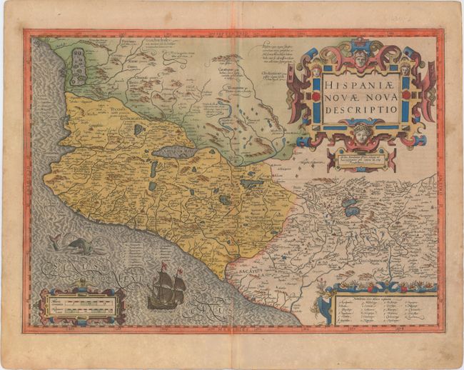
This splendid map illustrates the heart of the Spanish empire in the New World. The map is focused on the western part of Mexico from about Mazatlan to Acapulco (neither of which is named) and inland to include Lake Chapala and Mexico City, which is situated on a large lake. At upper left is a large inland sea filled with islands where the natives supposedly extracted salt. There are numerous notations, taken from Ortelius, that describe the native people including one that refers to cannibalism - Anthropophagi sunt, qui his montibus habitant (They who live in these mountains are cannibal). Diamond-shaped symbols mark the locations of numerous silver and copper mines. The map is fully decorated with three elaborate, strapwork cartouches. A Spanish Galleon and a fanciful sea monster adorn the ocean. Jodocus Hondius prepared this map for inclusion in his editions of the Mercator-Hondius atlas. Latin text on verso.
References:
Condition: B
Old color with light toning, some color offsetting mainly along the centerfold, and an archivally repaired centerfold separation that extends 2" into the image at bottom.